
Overview
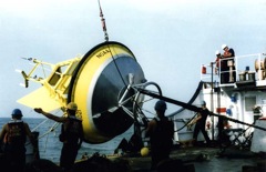
Through a grant from the John Adams Innovation Institute (JAII) of the Massachusetts Technology Collaborative (MTC), the Upper Ocean Processes (UOP) Group of the Woods Hole Oceanographic Institution (WHOI) is partnering with NOAA's National Data Buoy Center (NDBC) to augment meteorological observations on selected NDBC moorings. Measurements of surface downwelling shortwave and longwave radiation at multiple sites should enable researchers to improve flux estimates and bulk parameterizations in important ocean regions.
Instrumentation and Deployments
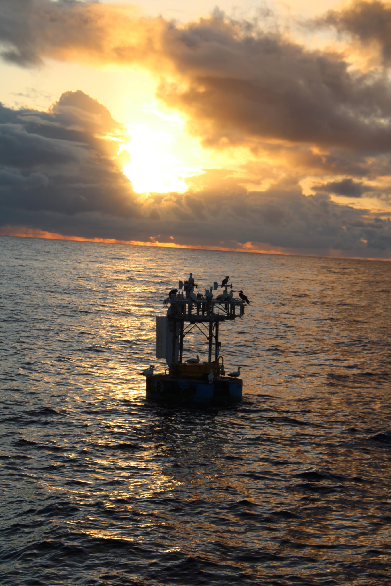
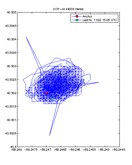
NDBC station 44008
For more information see the NDBC Station 44008 web page.Location: 40.502 N 69.247 W
Deployment Date: Apr 22, 2010
Deck height: Sea Surface
LWR SN: LWR230 Height above Deck: n/a
SWR SN: SWR230 Height above Deck: n/a
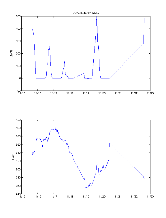
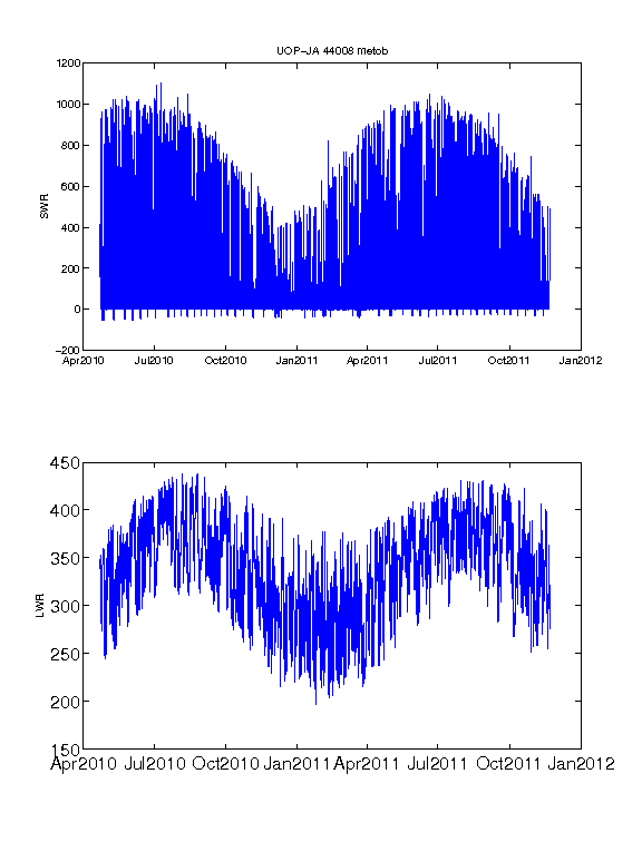
See also: full-length plot or
position plot
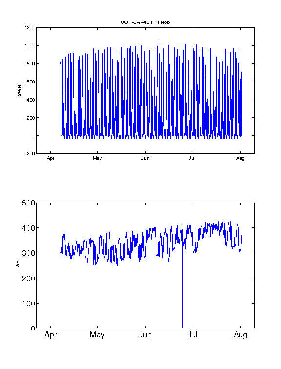
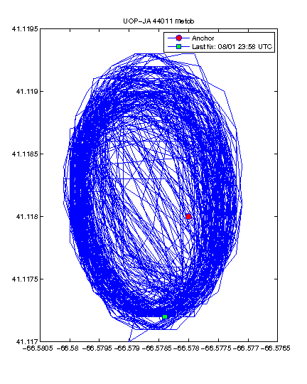
NDBC station 44011
For more information see the NDBC
Station 44011 web page.
Location: 41.118 N 66.578 W
Deployment Date: Apr 7, 2010
Deck height: 50 cm
LWR SN: LWR229 Height above Deck: 405 cm
SWR SN: SWR231 Height above Deck: 404 cm
Sensor level check:
SWR .8 deg. x-axis (fore=aft) and .5 deg. y-axis (port-starboard
on buoy)
LWR .6 deg. x-axis (fore-aft) and .5 deg. y-axis (port-starboard)
Deck of the buoy .6 deg. x-axis (fore-aft) and .5 deg. y-axis (port-starboard on buoy)
Note: Station 44011 stopped transmitting 8/1/2010; went adrift on 9/4/2010. Found on 10/3/2011 with no mast. Radiation sensors lost at sea.. This buoy will be restored to service when it can be worked into the NDBC schedule.
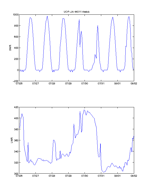
See also: full-length plot or
position plot
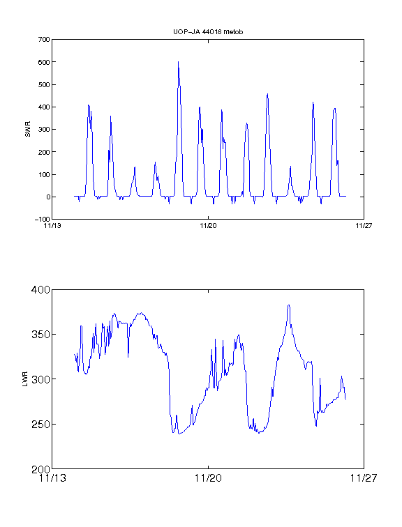
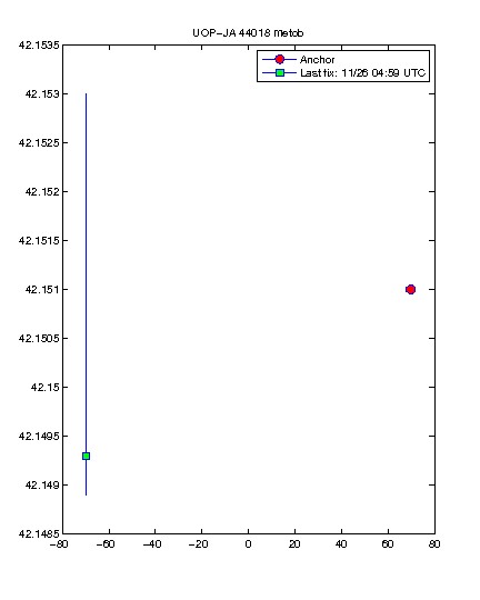
NDBC station 44018
For more information see the NDBC
Station 44018 web page.
Location: 42.151 N 69.817 W, approximately 17 nautical miles east-northeast of Provincetown, MA.
Deployment Date: Oct 13, 2011
LWR SN: LWR231 Height above Deck: 401 cm
SWR SN: SWR234 Height above Deck: 401 cm
Sensor level check:
Note: Station 44018 buoy is a foam hull
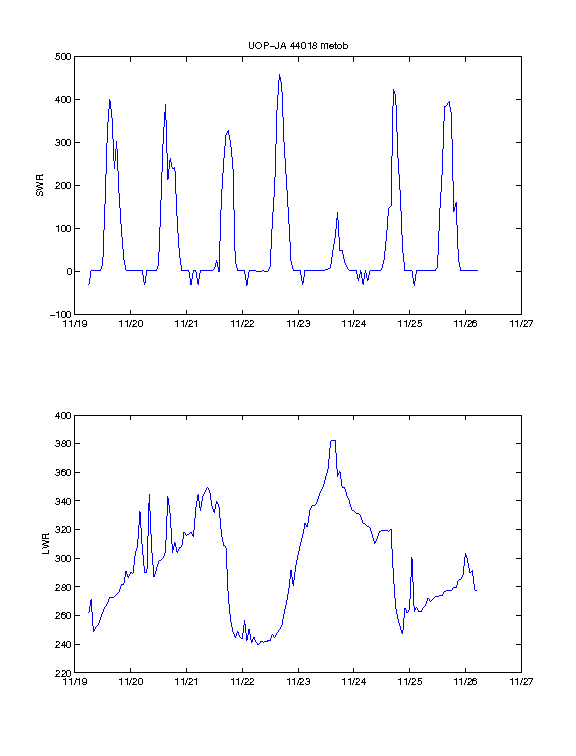
See also: full-length plot or
position plot
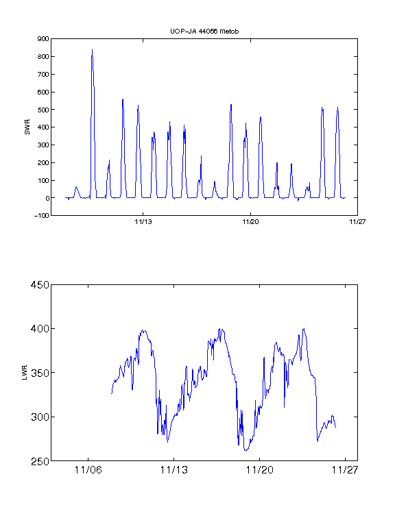
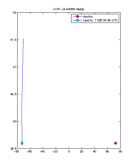
NDBC station 44066
For more information see the NDBC
Station 44066 web page.
Location: 39.601 N 72.618 W
Deployment Date: Oct 13, 2011
LWR SN: LWR235 Height above Deck: cm
SWR SN: SWR232 Height above Deck: cm
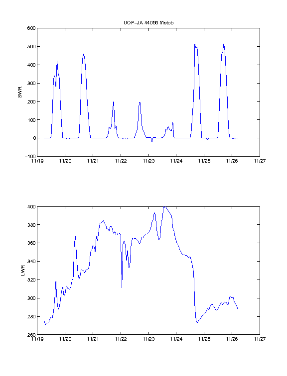
See also: full-length plot or
position plot
Data Access
Data is made available as text files at /completedprojects/NESF/data.
| station 44008 |
| station 44011 |
Files begin with comment lines that begin with % to make them Matlab-compatible.
Header lines include the name of the Matlab input file, which contains the NDBC buoy name,
the processing date, in local (Eastern) time, and the ending buoy position from the data
file. Note that east and north locations are positive numbers. There are also column header
and units lines:
% YY MM DD HH MM SWR LWR domeT caseT tpile tltmx tltmin tltmean tltstd
% w/m^2 w/m^2 degK degK volts deg deg deg deg
Fields are date (UTC), swr and lwr in W m-2 (watts per meter square), longwave dome and case
temperatures in degrees Kelvin, and longwave thermopile voltage. Also included are tilt values:
maximum, minimum, mean and standard deviation, which are included for possible troubleshooting.
Sponsors
Supported by JAII, the Massachusetts Technology Collaborative's John Adams Innovation Institute.
Text updated: December 15, 2009