Upper Ocean Processes Group
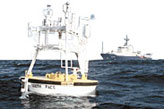
The primary focus of the Upper Ocean Processes Group is the study of physical processes in the upper ocean and at the air-sea interface using moored surface buoys equipped with meteorological and oceanographic sensors.
 The Upper Ocean Processes Group provides technical support to upper ocean
and air-sea interface science programs. Deep-ocean and shallow-water moored
surface buoy arrays are designed, fabricated, instrumented, tested, and
deployed at sea for periods of up to one year. Surface buoys are equipped
with meteorological sensors and recording packages with a satellite
telemetry capability. Volunteer Observing Ships (VOS) are outfitted with
the same meteorological sensors, but using different packaging.
Oceanographic instruments for the measurement of temperature, salinity,
and currents are routinely prepared, tested, and deployed on moorings.
Testing of meteorological and oceanographic sensors, both in the lab
and in the field, are ongoing. Pre- and post-deployment work relating
to the field deployments includes data acquisition, verification,
display, and archiving.
Another area of expertise is meteorological instrument calibration, including operation of a wind tunnel, constant temperature baths, a controlled humidity and temperature chamber, barometric pressure standards, and radiation sensors that can be used for comparison measurements. The group is also available to design new sensors to work with the recently developed, tested and now commercially available Air-Sea Interaction METeorology (ASIMET) sensors for buoys and ships.
Surface Reference Data
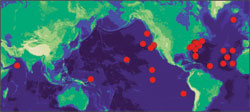
A particular focus for the Upper Ocean Processes Group is the collection of long-term, climate quality time series of surface meteorology and of the air-sea fluxes of heat, freshwater, and momentum at select locations known as Ocean Reference Stations (ORS). The surface meteorological data at the ORS are not, when available via satellite telemetry, placed on the GTS and are not used in atmospheric model initialization. Thus, these are independent, withheld data of use for model validation. At the same time, the processes of calibrating the meteorological sensors and quality controlling the data are rigorous and well-documented.
We maintain three ORS at present, Stratus, NTAS, and WHOTS. Typically, the surface mooring is serviced annually, and the new surface mooring is overlapped with the old mooring for one to several days. The data from each deployment, including real time data from current deployments, are available under the Current Projects button to the left. To facilitate use of the data, we have merged the different years at each sites for the spans of years when there have not been gaps. This merging includes retrospective reprocessing to correct sensor errors, drift, and biases and also makes adjustments based on ship-buoy inter comparisons and lab calibrations when merging successive years. Because of gaps when mooring failures occurred, there are one or more merged files at each site. The buoys are not reset in exactly the same location, but the time series have been merged and presented as from one site. These merged Reference Data Sets and supporting documentation will be made available at hourly, daily, and monthly time resolution under the Surface Reference Data button to the left.
Data Management
Data from our Ocean Reference Stations is managed in compliance with the OceanSITES project, so our data is made freely available as soon as possible, in a standard format that is well documented and easily used. Near real time data telemetered from selected instruments on our buoys, as well as delayed mode, processed data are available from this site, uop.whoi.edu, and from the OceanSITES Global Data Assembly Centers at NDBC and at IFREMER.
Please bear with us as we transition to our new web site. If you need somthing from the old site, it is available temporarily at ocelot.whoi.edu.
Last updated: December 9, 2016.


