Upper Ocean Processes (UOP)
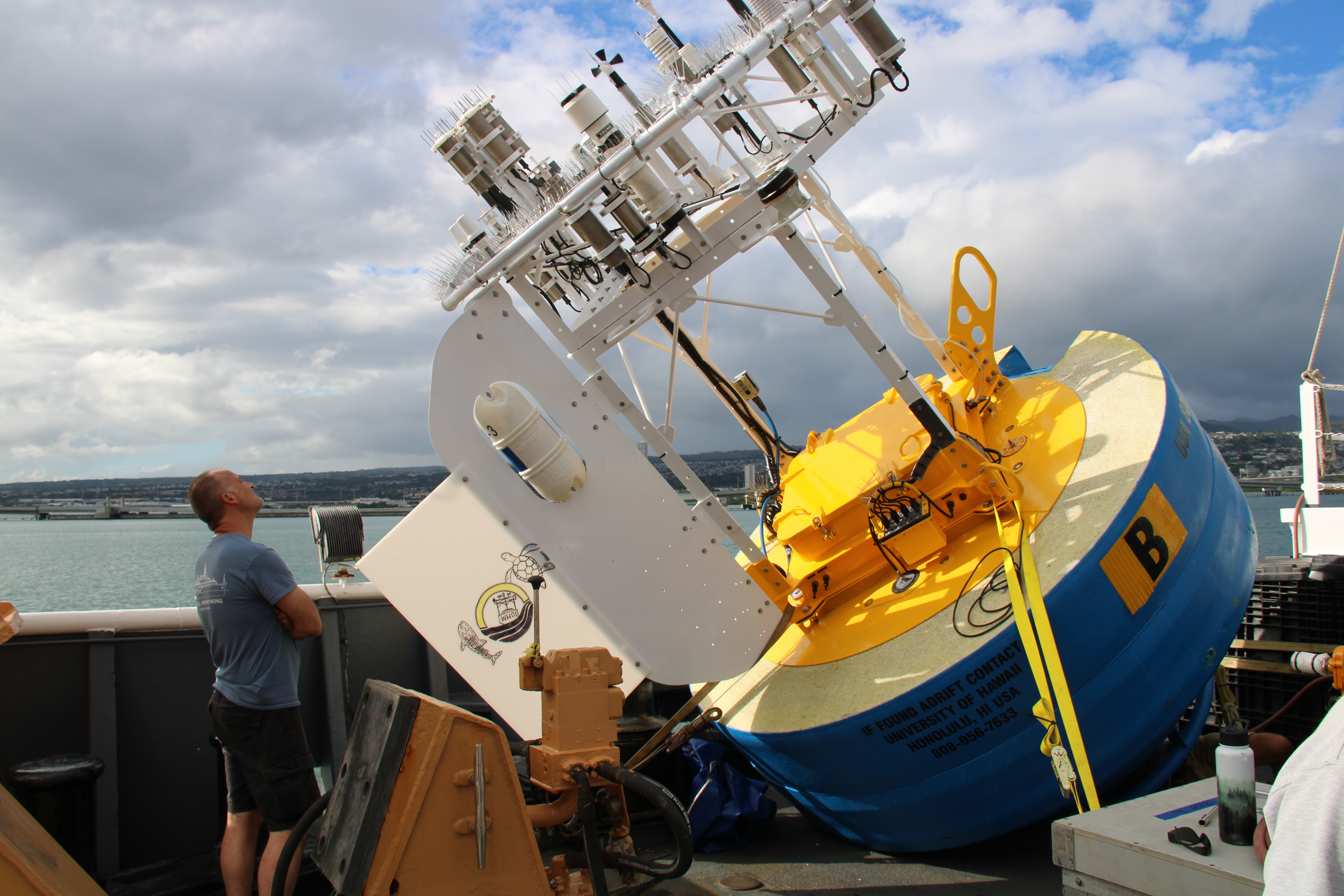
The primary focus of the Upper Ocean Processes Group is the study of air-sea interaction and upper ocean processes using moored surface buoys equipped with meteorological and oceanographic sensors. Depending on the process being studied, a variety of instruments and techniques may be used, from instrumented moorings to autonomous vehicles

Data from currently active projects are accessible from the (Current Projects) tab. An archive of data from over 30 prior projects can be found under the (All Projects) tab.
The Upper Ocean Processes Group provides technical support to upper ocean and air-sea interface science programs. Deep-ocean and shallow-water moored surface buoy arrays are designed, fabricated, instrumented, tested, and deployed. Surface buoys are equipped with meteorological sensors and recording packages with a satellite telemetry capability. Oceanographic instruments for the measurement of temperature, salinity, and currents are routinely prepared, tested, and deployed on moorings. Pre- and post-deployment work relating to the field deployments includes data processing, quality control, display, and archiving. An area of expertise for the group is meteorological instrument calibration, including operation of a wind tunnel, constant temperature baths, controlled humidity and temperature chamber, barometric pressure standards, and radiation standards
Reference Data Sets
At select locations known as Ocean Reference Stations (ORS) the Upper Ocean Processes Group is developing long time series of high-quality oceanographic and marine meteorological data. The sensors are calibrated and the data are quality controlled. The surface meteorological data from the ORS are not placed on the Global Telecommunications System (GTS) network and are not available for atmospheric model initialization. Thus, these are independent, “withheld” data useful for model validation. The meteorological data sets allow computation of the air-sea fluxes of heat, freshwater, and momentum. Sensors deployed above the anchors of the ORS moorings allow development of long time series of deep ocean temperature. Upper ocean temperature, salinity and velocity from individual deployments are also available.
The merged Reference Data Sets and supporting documentation are available under the (Reference Data Sets) tab.
Data Access and Use
Data from our Ocean Reference Stations is managed in compliance with the OceanSITES project and with F.A.I.R data standards. Our data is made freely available to the public and science community as soon as possible, in standardized, documented formats. Near real-time data telemetered from selected instruments on our buoys, as well as delayed mode, processed data are available from this site, uop.whoi.edu, and from the OceanSITES Global Data Assembly Centers at NDBC and at IFREMER.
We request that publications leveraging UOP data include a data acknowledgement such as:
Data were provided by the Upper Ocean Processes Group at the Woods Hole Oceanographic Institution.
Funding sources, principal investigators, and affiliated organizations vary across projects. Available information specific to each dataset is embedded within NetCDF file metadata.
Last updated: 2026/06/04