
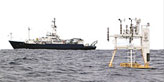
Project WHOTS - WHOI Hawaii Ocean Time-series Station
| Sponsors | ||
| ||

| Related Information |
| See details page for mooring logs, mooring diagrams, and cruise reports |
| See real-time data page for later deployments |
| External links |
| UH Subsurface data |
| Time-series plots |
| WHOTS-I Met time series plot Surface Velocity plot |
| WHOTS-II Met time series plot Surface Velocity plot |
| WHOTS-III Met time series plot Surface Velocity plot |
| WHOTS-IV Met time series plot Surface Velocity plot |
| WHOTS-V Met time series plot Surface Velocity plot |
| WHOTS-VI Met time series plot Surface Velocity plot |
| WHOTS-VII Met time series plot Surface Velocity plot |
| WHOTS-VIII Met time series plot Surface Velocity plot |
| WHOTS-IX Met time series plot Surface Velocity plot |
| WHOTS-X Met time series plot Surface Velocity plot |
| WHOTS-XI Met time series plot No surface Velocity available |
| WHOTS-XII Met time series plot Surface Velocity plot |
| WHOTS-XIII Met time series plot No surface Velocity available |
| WHOTS-XIV Met time series plot Surface Velocity plot |
| WHOTS-XV Met time series plot Surface Velocity plot |
| WHOTS-XVI Met time series plot Surface Velocity plot |
| WHOTS-XVII Met time series plot Surface Velocity plot |
Archived Data
Notes
As data becomes available it is added to this secton of the NTAS site; it may
still be subject to updates, however. Please note the version date as well
as the citation for any data you download.
For unedited data from more recent deployments of the WHOTS platform, received
via satellite, please see the real time data section, above.
A full description of the OceanSITES NetCDF specification used for UOP datasets
is available on the OceanSITES web site.
Variable "standard names" are taken from the
Climate
and Forecast NetCDF specification.
Meteorological data contained on this site is collected by ASIMet loggers. More detailed
information about this instrument package is available
at /UOPinstruments/UOPinstruments.html.
The ASIMET meteorological sensors on the buoy provided a record of:
- Wind velocity
- Relative Humidity
- Air and Sea surface Temperatures
- Incoming Shortwave Radiation
- Incoming Longwave Radiation
- Barometric Pressure
- Precipitation
Subsurface temperature, conductivity and velocity data from WHOTS deployments are handled by the University of Hawaii. Please visit the UH WHOTS Database to access.
Download Data
NetCDF (OceanSITES standard) files
are available for download.
All data presented here should be considered preliminary as further adjustments to the data may be needed. Please note the version date as well as the citation for any data you download.
Note: Surface current data presented here is meant to represent the data used in flux calculations, NOT as the authoritative source of WHOTS current velocity data. Also, it is in draft NetCDF form, please bear with us!
Acknowledgement
When using the data, please acknowledge the source: "Data from the WHOTS Ocean Reference Station were made available by the Upper Ocean Processes Group of the Woods Hole Oceanographic Institution. The WHOTS project is supported in part by the National Oceanic and Atmospheric Administration (NOAA) Global Ocean Monitoring and Observing (GOMO) Program through the Cooperative Institute for the North Atlantic Region (CINAR) under Cooperative Agreement NA14OAR4320158. NOAA CPO FundRef number (100007298). Additional support is provided by the National Science Foundation, Division of Ocean Sciences."
WHOTS 1
Set: Aug 13, 2004, 02:40 UTC, R/V Ka´imikai-o-Kanaloa, cruise KOK 04-14
Recovered:Jul 25, 2005 17:15 UTC, R/V Melville
Position: 22° 46´N, 157° 54´W
Water depth: 4693 meters
Surface velocity from VMCM 12 at 10m until 18-Apr-2005 05:15, then from VMCM 19 at 30m
| Type | NetCDF | Metadata | Text file |
| Met | OS_WHOTS_2004_D_M.nc | OS_WHOTS_2004_D_M.cdl | OS_WHOTS_2004_D_M.asc.gz |
| Vel | OS_WHOTS_2004_D_surfV.nc | OS_WHOTS_2004_D_surfV.cdl | OS_WHOTS_2004_D_surfV.asc.gz |
WHOTS 2
Set: July 28, 2005 01:43 UTC, R.V. Melville, cruise TUIM10MV
Recovered: June 24, 2006 18:30 UTC, R.V. Revelle, cruise AMAT07
Position: 22° 46´N, 157° 54´W
Water depth: 4695 meters
Surface velocity from VMCM 66 at 10m
| Type | NetCDF | Metadata | Text file |
| Met | OS_WHOTS_2005_D_M.nc | OS_WHOTS_2005_D_M.cdl | OS_WHOTS_2005_D_M.asc.gz |
| Vel | OS_WHOTS_2005_D_surfV.nc | OS_WHOTS_2005_D_surfV.cdl | OS_WHOTS_2005_D_surfV.asc.gz |
WHOTS 3
Set: June 26 2006, 23:47 UTC, R/V Revelle, cruise AMAT07
Recovered: June 26, 2007 16:00 UTC, R/V Kilo Moana, cruise KM-07-08
Position: 22° 46´N, 157° 54´W
Water depth: 4703 meters
Surface velocity from VMCM 35 at 10m
| Type | NetCDF | Metadata | Text file |
| Met | OS_WHOTS_2006_D_M.nc | OS_WHOTS_2006_D_M.cdl | OS_WHOTS_2006_D_M.asc.gz |
| Vel | OS_WHOTS_2006_D_surfV.nc | OS_WHOTS_2006_D_surfV.cdl | OS_WHOTS_2006_D_surfV.asc.gz |
WHOTS 4
Set: June 25, 2007, 23:49 UTC, R/V Kilo Moana, cruise KM 07-08
Recovered: June 6, 2008, 17:20 UTC, R/V Kilo Moana, cruise KM 07-08
Position: 22° 40´N, 157° 57´W
Water depth: 4756 meters
Surface velocity from VMCM 34 at 10m until 07-Apr-2008 01:53, then from VMCM 40 at 30m
| Type | NetCDF | Metadata | Text file |
| Met | OS_WHOTS_2007_D_M.nc | OS_WHOTS_2007_D_M.cdl | OS_WHOTS_2007_D_M.asc.gz |
| Vel | OS_WHOTS_2007_D_surfV.nc | OS_WHOTS_2007_D_surfV.cdl | OS_WHOTS_2007_D_surfV.asc.gz |
WHOTS 5
Set: June 5, 2008 , 03:25 UTC, R/V Kilo Moana, cruise KM 08-08
Recovered: July 15, 2009, 16:51 UTC, R/V Kilo Moana, cruise KM 09-16
Position: 22° 46.064´N, 157° 54.085´W
Water depth: 4702 meters
Surface velocity from VMCM 37 at 30m until 17-Apr-2009 12:00, then from ADCP 2530 at 36m
| Type | NetCDF | Metadata | Text file |
| Met | OS_WHOTS_2008_D_M.nc | OS_WHOTS_2008_D_M.cdl | OS_WHOTS_2008_D_M.asc.gz |
| Vel | OS_WHOTS_2008_D_surfV.nc | OS_WHOTS_2008_D_surfV.cdl | OS_WHOTS_2008_D_surfV.asc.gz |
WHOTS 6
Set: July 11, 2009 , 01:19 UTC, R/V Kilo Moana, cruise KM 09-16
Recovered: August 2, 2010, 17:11 UTC, R/V Kilo Moana, cruise KM 10-14
Position: 22° 39.99´N, 157° 56.96´W
Water depth: 4758 meters
Surface velocity from
| Type | NetCDF | Metadata | Text file |
| Met | OS_WHOTS_2009_D_M.nc | OS_WHOTS_2009_D_M.cdl | OS_WHOTS_2009_D_M.asc.gz |
| Vel | OS_WHOTS_2009_D_surfV.nc | OS_WHOTS_2009_D_surfV.cdl | OS_WHOTS_2009_D_surfV.asc.gz |
WHOTS 7
Set: July 29, 2010 02:37 UTC , R/V Kilo Moana, cruise KM 10-14
Recovered: July 11, 2011, 16:28 UTC, from the RV Hi'ialakai cruise HA-11-02
Position: 22° 46.0052´N, 157° 53.9897´W
Water depth: 4703.8 meters
Surface velocity from VMCM 58 at 30m
| Type | NetCDF | Metadata | Text file |
| Met | OS_WHOTS_2010_D_M.nc | OS_WHOTS_2010_D_M.cdl | OS_WHOTS_2010_D_M.asc.gz |
| Vel | OS_WHOTS_2010_D_surfV.nc | OS_WHOTS_2010_D_surfV.cdl | OS_WHOTS_2010_D_surfV.asc.gz |
WHOTS 8
Set: July 7, 2011 01:00 UTC , RV Hi'ialakai cruise HA-11-02
Recovered: June 16, 2011, 17:47 UTC, from the RV Hi'ialakai cruise HA-12-02
Position: 22° 40.157´N, 157° 57.023´W
Water depth: 4750 meters
Surface velocity from VMCM 16 at 10m
| Type | NetCDF | Metadata | Text file |
| Met | OS_WHOTS_2011_D_M.nc | OS_WHOTS_2011_D_M.cdl | OS_WHOTS_2011_D_M.asc.gz |
| Vel | OS_WHOTS_2011_D_surfV.nc | OS_WHOTS_2011_D_surfV.cdl | OS_WHOTS_2011_D_surfV.asc.gz |
WHOTS 9
Set: June 14 2012 at 02:23 UTC , RV Hi'ialakai cruise HA-12-02
Recovered: July 14, 2013, 16:17 UTC, from the RV Hi'ialakai cruise HA-13-03
Position: 22° 46.071´N, 157° 53.956´W
Water depth: 4668 meters
Surface velocity from VMCM 16 at 10m
WHOTS 10
Set: July 11 2013 at 04:27 UTC , RV Hi'ialakai cruise HA-13-03
Recovered: July 20, 2014, 16:23 UTC, from the RV Hi'ialakai cruise HA-14-03
Position: 22° 40.118´N, 157° 57.010´W
Water depth: 4756 meters
WHOTS 11
Set: July 17, 2014 02:40:00 UTC , RV Hi'ialakai cruise HA-14-03
Recovered: July 14, 2015, 16:56 UTC, from the RV Hi'ialakai cruise HA-15-04
Position: 22° 45.981´N, 157° 53.964´W
Water depth: 4707 meters
Note: Surface currents are not available for this deployment
| Type | NetCDF | Metadata | Text file |
| Met | OS_WHOTS_2014_D_M.nc | OS_WHOTS_2014_D_M.cdl | OS_WHOTS_2014_D_M.asc.gz |
| Vel | No surface currents available | ||
| DeepTS | OS_WHOTS_201407_D_SEACAT-4671m-SN1880.nc | OS_WHOTS_201407_D_SEACAT-4671m-SN1880.cdl | OS_WHOTS_201407_D_SEACAT-4671m-SN1880.asc.gz |
| DeepTS | OS_WHOTS_201407_D_SEACAT-4671m-SN1881.nc | OS_WHOTS_201407_D_SEACAT-4671m-SN1881.cdl | OS_WHOTS_201407_D_SEACAT-4671m-SN1881.asc.gz |
WHOTS 12
Set: July 12, 2015 02:20:00 UTC , RV Hi'ialakai cruise HA-15-04
Recovered: June 29, 2016, 17:47 UTC, from the RV Hi'ialakai cruise HA-16-05
Position: 22° 40.061´N, 157° 56.9654´W
Water depth: 4707 meters
WHOTS 13
Set: June 27, 2016 08:48:00 UTC , RV Hi'ialakai cruise HA-16-05
Recovered: August 1, 2017, 01:55 UTC, from the RV Hi'ialakai cruise HA-17-02
Position: 22° 47.402´N, 157° 54.481´W
Water depth: 4693 meters
Note: Surface currents are not available for this deployment
| Type | NetCDF | Metadata | Text file |
| Met | OS_WHOTS_2016_D_M.nc | OS_WHOTS_2016_D_M.cdl | OS_WHOTS_2016_D_M.asc.gz |
| Vel | No surface currents available | ||
| DeepTS | OS_WHOTS_201606_D_MICROCAT-4657m-SN12246.nc | OS_WHOTS_201606_D_MICROCAT-4657m-SN12246.cdl | OS_WHOTS_201606_D_MICROCAT-4657m-SN12246.asc.gz |
| DeepTS | OS_WHOTS_201606_D_MICROCAT-4657m-SN12247.nc | OS_WHOTS_201606_D_MICROCAT-4657m-SN12247.cdl | OS_WHOTS_201606_D_MICROCAT-4657m-SN12247.asc.gz |
WHOTS 14
Set: July 28, 2017, 02:19 UTC, from the RV Hi'ialakai cruise HA-17-02
Recovered: September 26, 2018, 16:57 UTC, from the RV Hi'ialakai cruise HA-18-03
Position: 22° 40.015´N, 157° 57.092´W
Water depth: 4722 meters
WHOTS 15
Set: September 23, 2018, 01:17 UTC, from the R/V Hi'ialakai cruise HA-18-03
Recovered: October 8, 2019, 17:00 UTC, from the R/V Sette SE-20-01
Position: 22° 46.045´N, 157° 53.888´W
Water depth: 4697 meters
WHOTS 16
Set: October 6, 2019, 02:12 UTC from R/V Sette, cruise SE-20-01
Recovered: August 28, 2021 17:52 UTC, from R/V Sette, cruise SE-21-03
Position: 22° 40.096´N, 157° 56.7888´W
Water depth: 4753
WHOTS 17
Set: August 26, 2021, 03:13 UTC from R/V Sette, cruise SE-21-03
Recovered: July 25, 2022 18:03 UTC, from R/V Sette, cruise SE-22-05
Position: 22° 46.002´N, 157° 53.958´W
Water depth: 4699
WHOTS 18
Set: July 24, 2022, 02:17 UTC from R/V Sette, cruise SE-22-05
Recovered: June 18, 2023, 17:49 UTC from R/V Sette, cruise SE-23-02
Position: 22° 40.021´N, 157° 57.018´W
Water depth: 4750
WHOTS 19
Set: June 17, 2023, 02:59 UTC from R/V Sette, cruise SE-23-02
Recovered: June 6, 2023, 18:00 UTC from R/V Sette, cruise SE-24-05
Position: 22° 46.057´N, 157° 53.964´W
Water depth: 4705
Last updated: 2025/04/14