| Notes | ASIMet data formats | Resolution | Copy of UOP instrument database | Argos Code | Campbell power consumption tool |
|---|
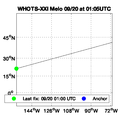
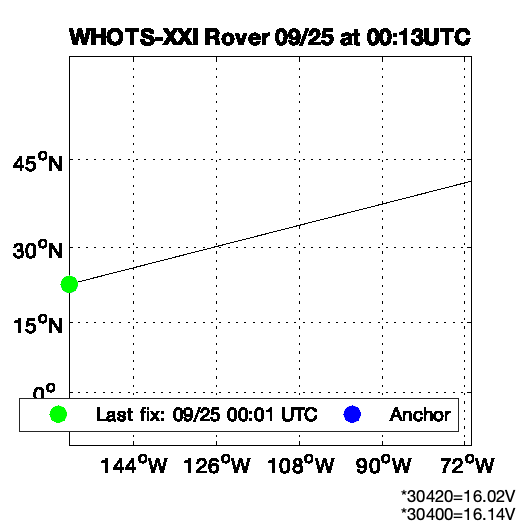
The WHOTS-XXI buoy was deployed on 9/24/25 00:53:00.
The WHOTS-XXI site is WMO ID 58400, NDBC Partner Platform 51WH0 -- last updated 2025/11/14 18:30.
System 1 and System 3 IMEI's swapped on 9/23/2025 while in port.
| System | SN | IMEI | Daily | Complete | ||
|---|---|---|---|---|---|---|
| Sys1 | 5 | *2180 | Raw | QC | Raw | QC |
| Sys2 | 42 | *0650 | Raw | QC | Raw | QC |
 |
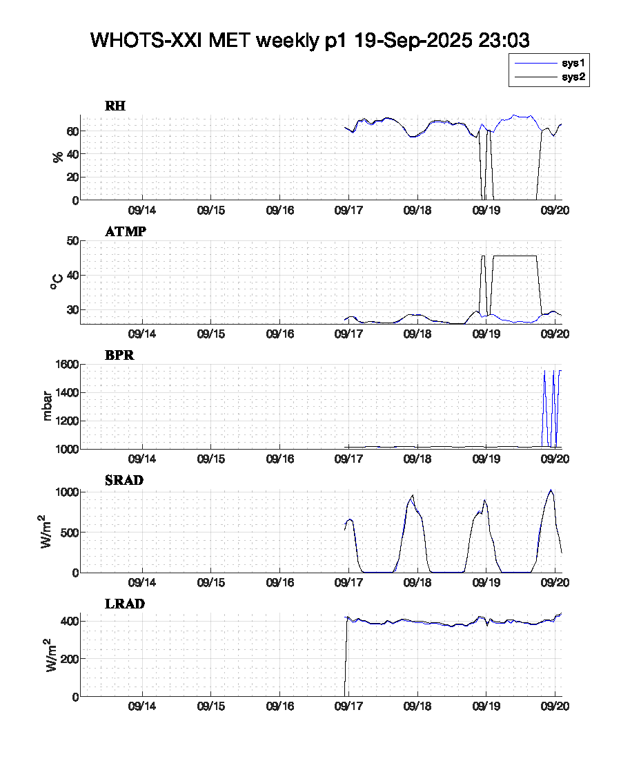 |
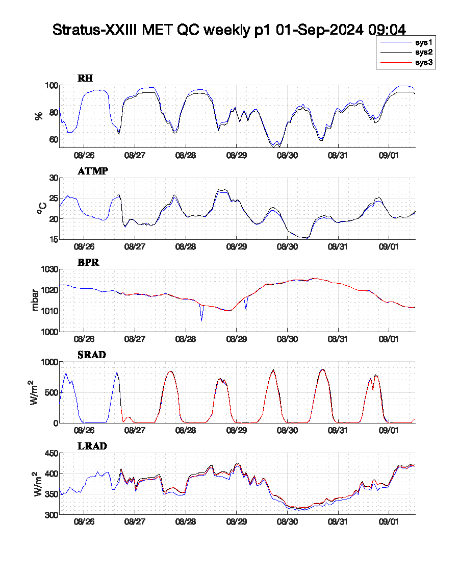
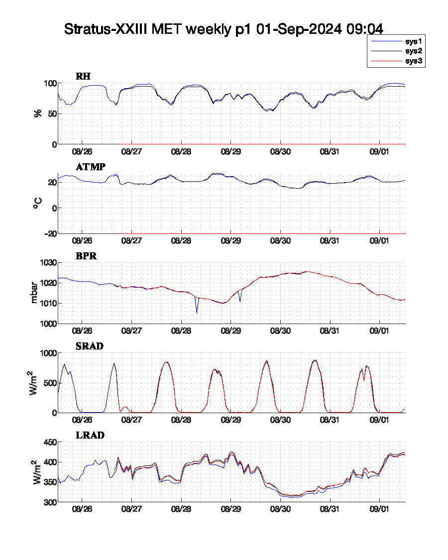
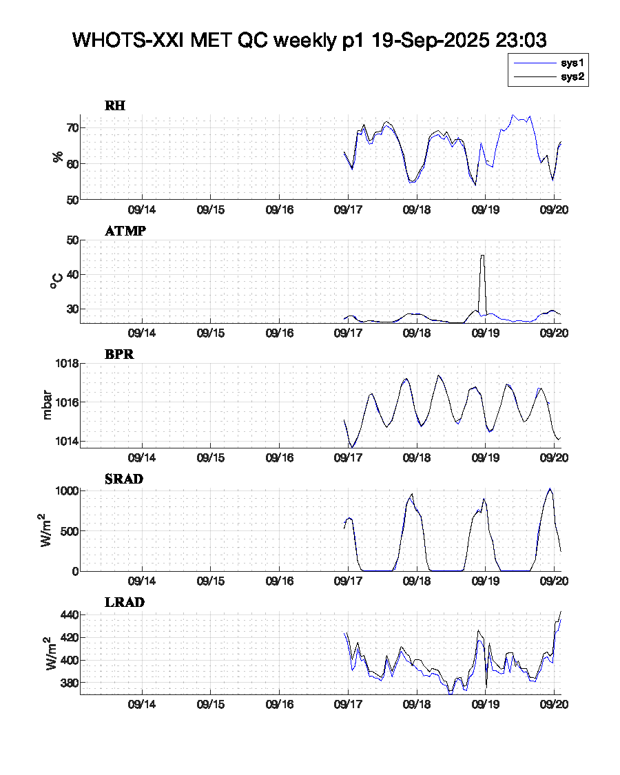
| WHOTS-XXI MET QC p1 (complete) | WHOTS-XXI MET p1 (complete) |
 |
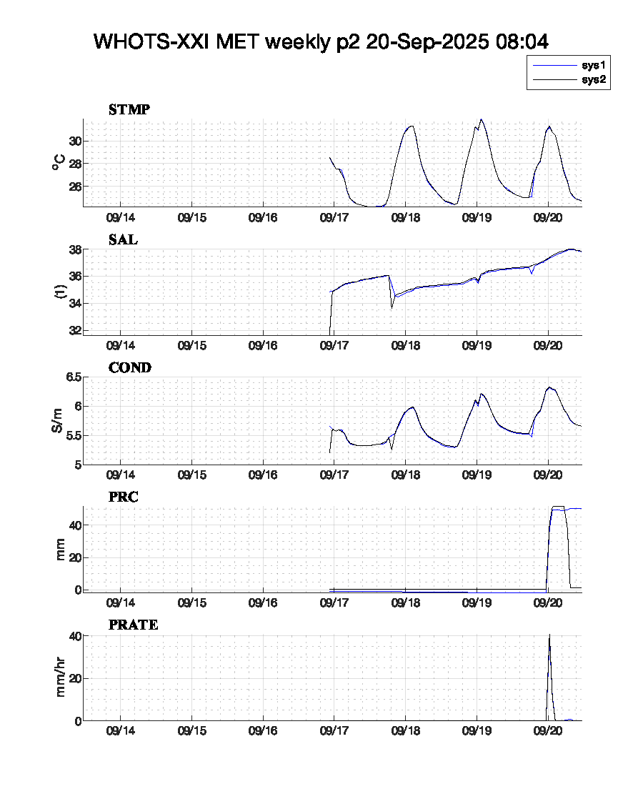 |
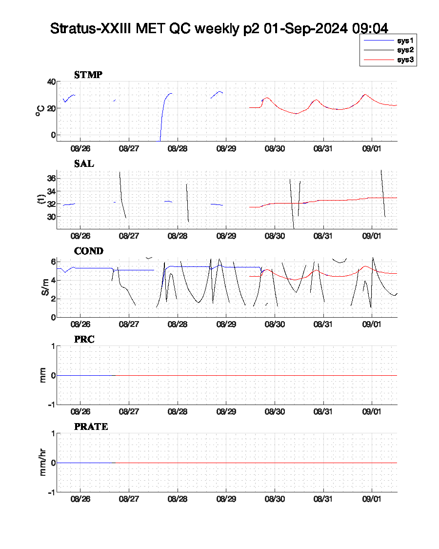
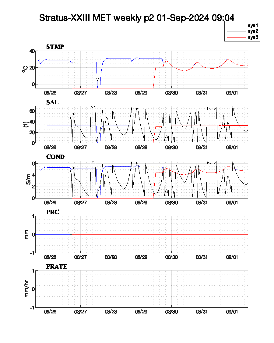
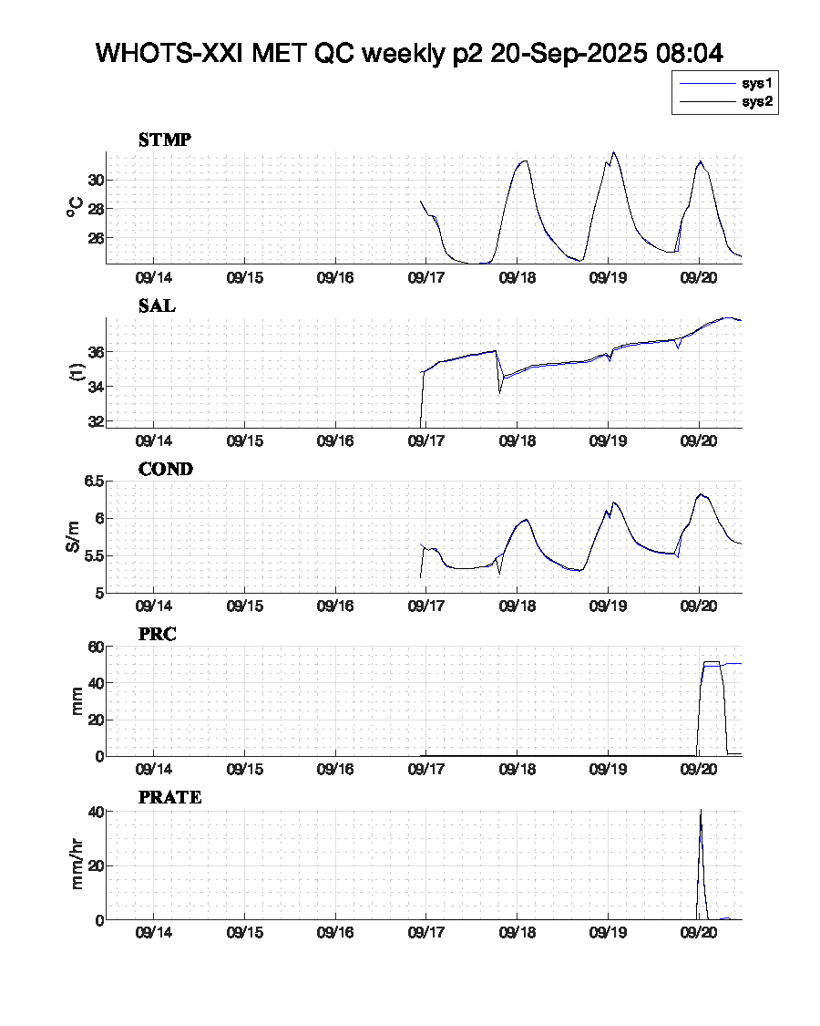
| WHOTS-XXI MET QC p2 (complete) | WHOTS-XXI MET p2 (complete) |
 |
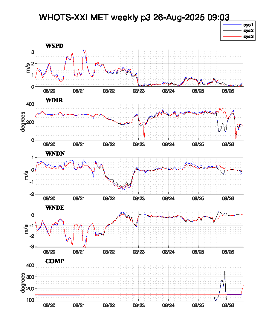 |
| WHOTS-XXI MET QC p3 (complete) | WHOTS-XXI MET p3 (complete) |
WHOTS-XXI anchor: 22.7665N, 157.9009W.
| Instrument | ID | Daily | Complete | Throughput | |
|---|---|---|---|---|---|
| Xeos Melo | 300034013707580 | Melo GPS | Melo GPS | throughput | |
| Xeos Rover | *4530420, *4530400 | Rover GPS | Rover GPS | throughput | |
| Beacon Modem | 300234067205440 | Beacon GPS | |||
| Google Earth | WHOTS-XXI.kml |
 |
 |
| Notes | ASIMet data formats | Resolution | Copy of UOP instrument database | Argos Code | Campbell power consumption tool |
|---|
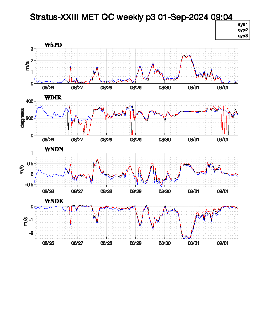
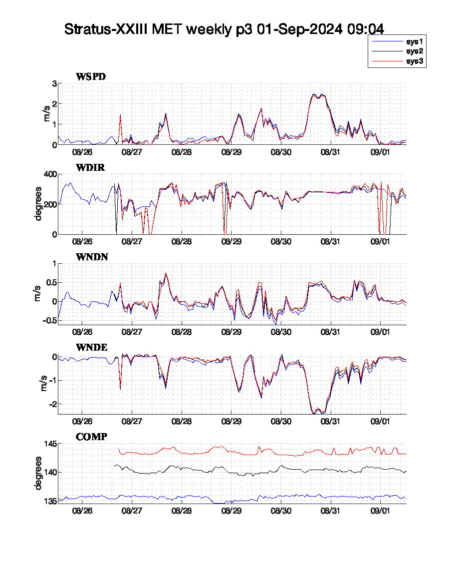
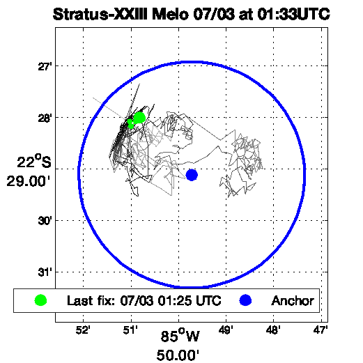
The Stratus-XXIII buoy was deployed on 3/15/2025 21:08:00.
The Stratus-XXIII site is WMO ID 38400, NDBC Partner Platform 32ST0 -- last updated 2025/11/14 18:30.
Sys 1 2025/04/06 Telemetry interruption.
| System | SN | IMEI | Daily | Complete | ||
|---|---|---|---|---|---|---|
| Sys1 | 4 | *1510 | Raw | QC | Raw | QC |
| Sys2 | 14 | *1050 | Raw | QC | Raw | QC |
Stratus-XXIII anchor: 22.4853S, 85.8287W.
| Instrument | ID | Daily | Complete | Throughput | |
|---|---|---|---|---|---|
| Xeos Melo | 300034013701980 | Melo GPS | Melo GPS | throughput | |
| Xeos Rover | *3443730, *3448720 | Rover GPS | Rover GPS | throughput | |
| Beacon Modem | 300234062945460 | Beacon GPS | |||
| Google Earth | Stratus-XXIII.kml |
 |
 |
| Notes | ASIMet data formats | Resolution | Copy of UOP instrument database | Argos Code | Campbell power consumption tool |
|---|
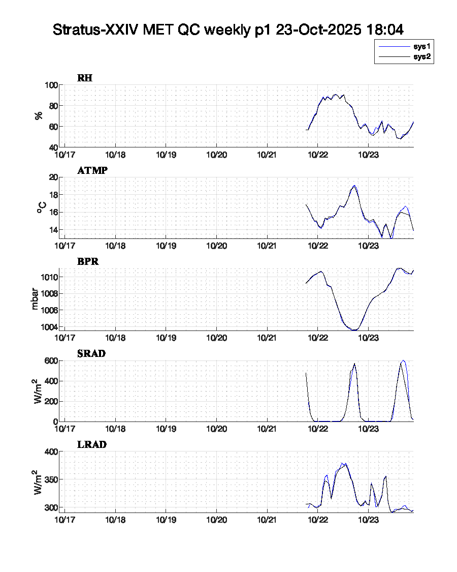
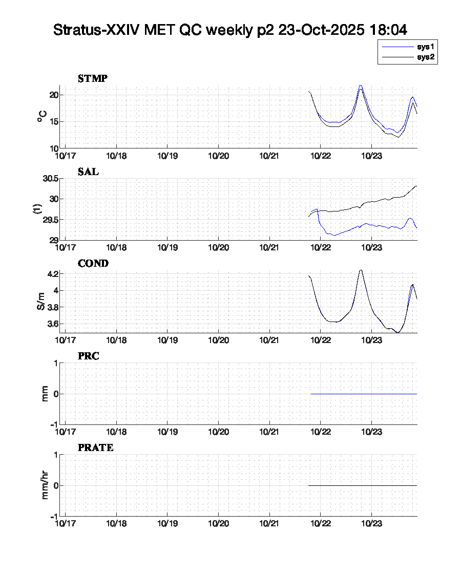
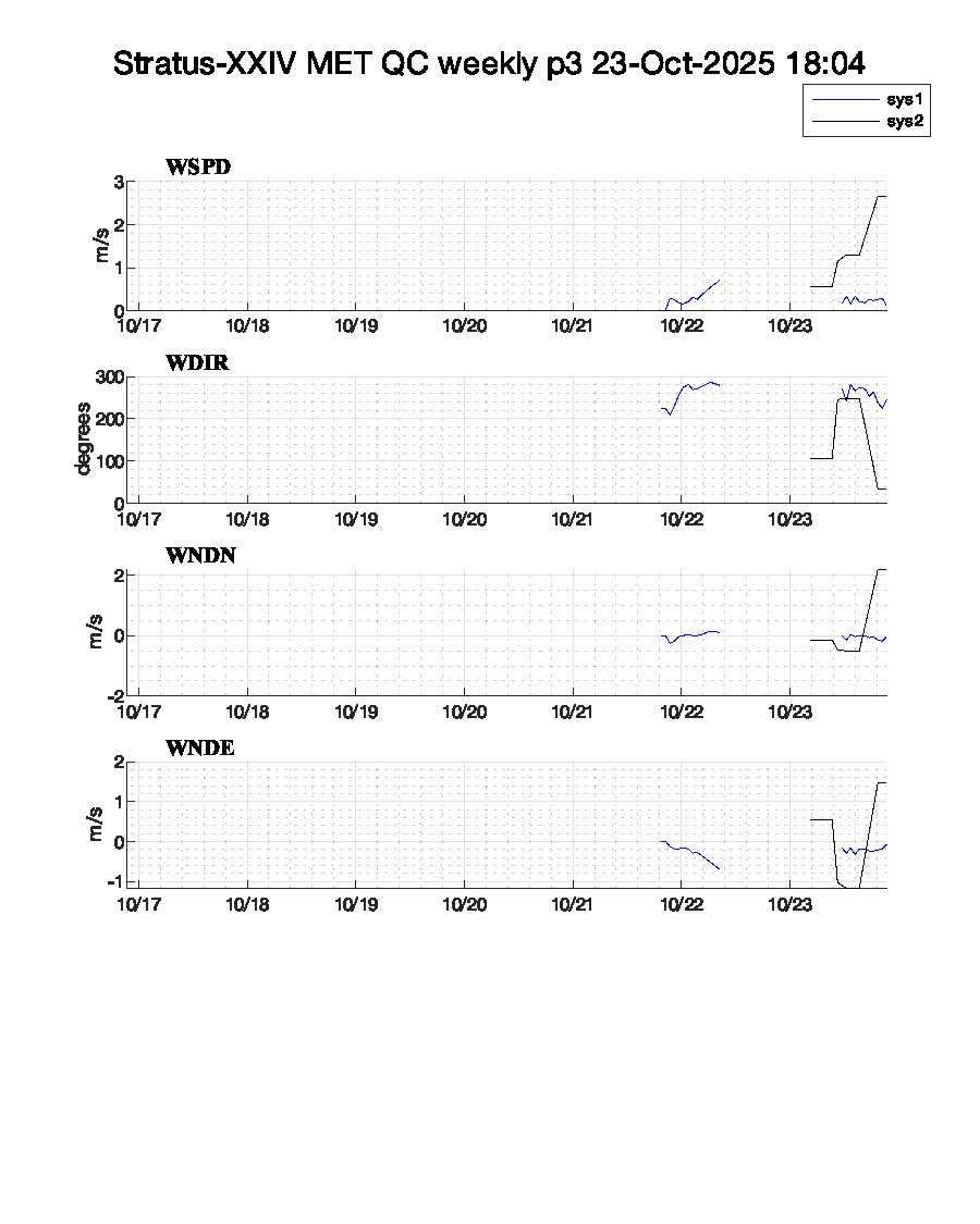
The Stratus-XXIV buoy is currently in-prep.
2025/10/21 ~14:30 sys1 and sys2 powered on for burn-in.
| System | SN | IMEI | Daily | Complete | ||
|---|---|---|---|---|---|---|
| Sys1 | 1 | *9760 | Raw | QC | Raw | QC |
| Sys2 | 8 | *6220 | Raw | QC | Raw | QC |
 |
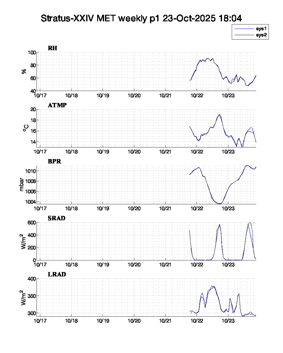 |
| Stratus-XXIV MET QC p1 (complete) | Stratus-XXIV MET p1 (complete) |
 |
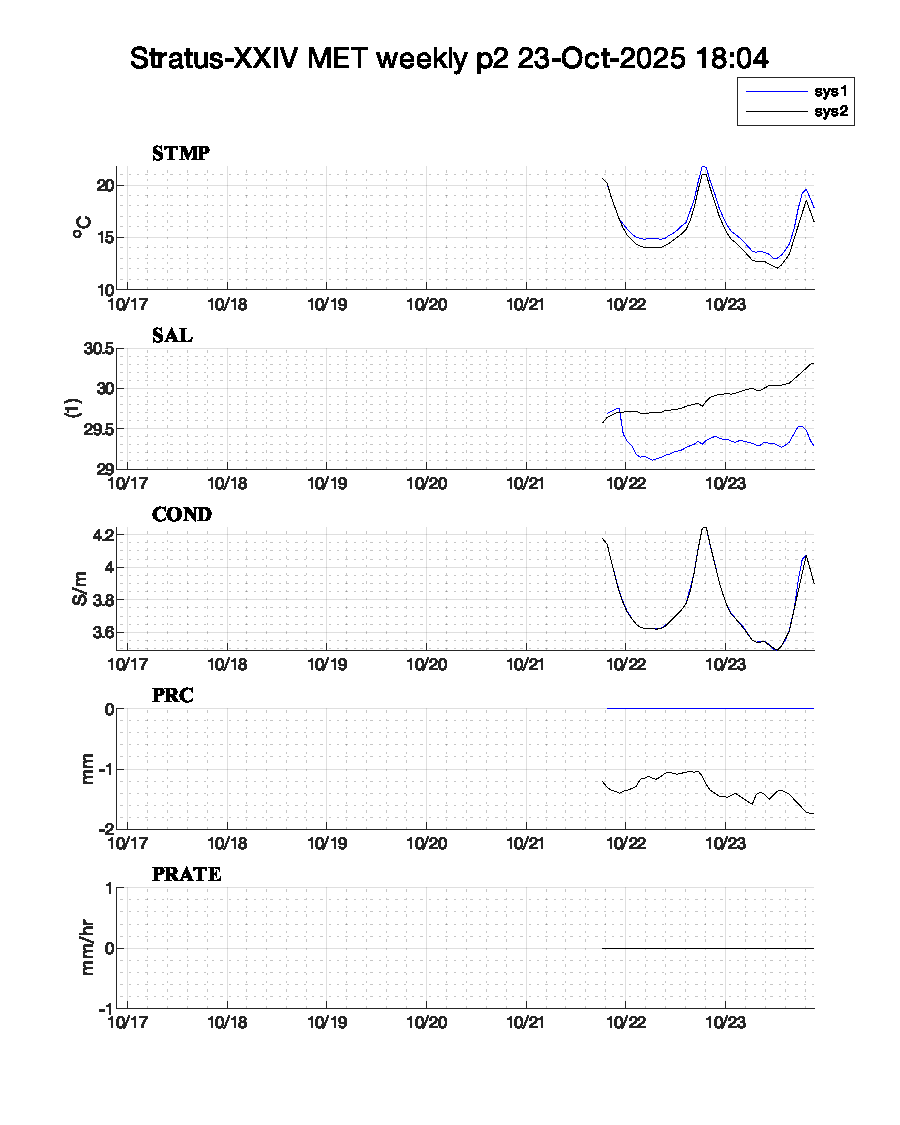 |
| Stratus-XXIV MET QC p2 (complete) | Stratus-XXIV MET p2 (complete) |
 |
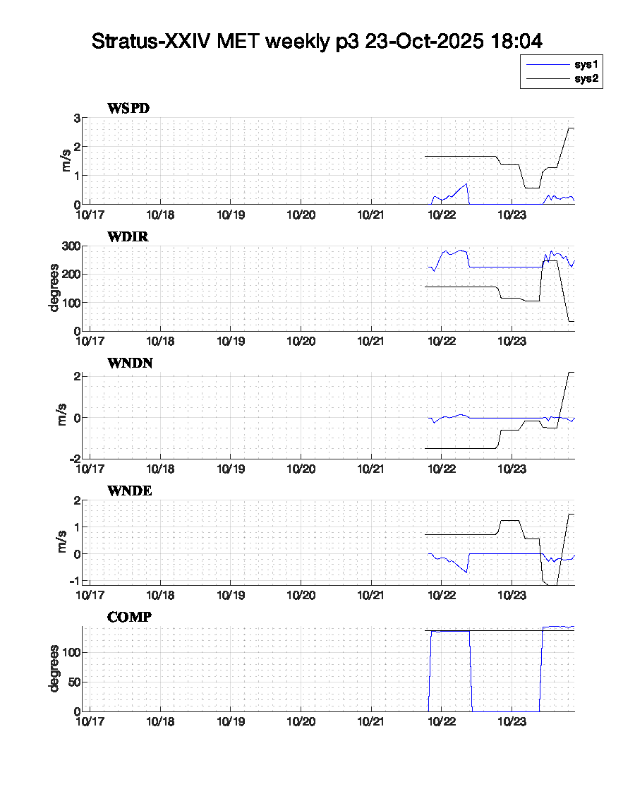 |
| Stratus-XXIV MET QC p3 (complete) | Stratus-XXIV MET p3 (complete) |
Stratus-XXIV is not currently anchored; plots will be centered on most recent position data.
| Instrument | ID | Daily | Complete | Throughput | |
|---|---|---|---|---|---|
| Google Earth | Stratus-XXIV.kml |
| Notes | ASIMet data formats | Resolution | Copy of UOP instrument database | Argos Code | Campbell power consumption tool |
|---|
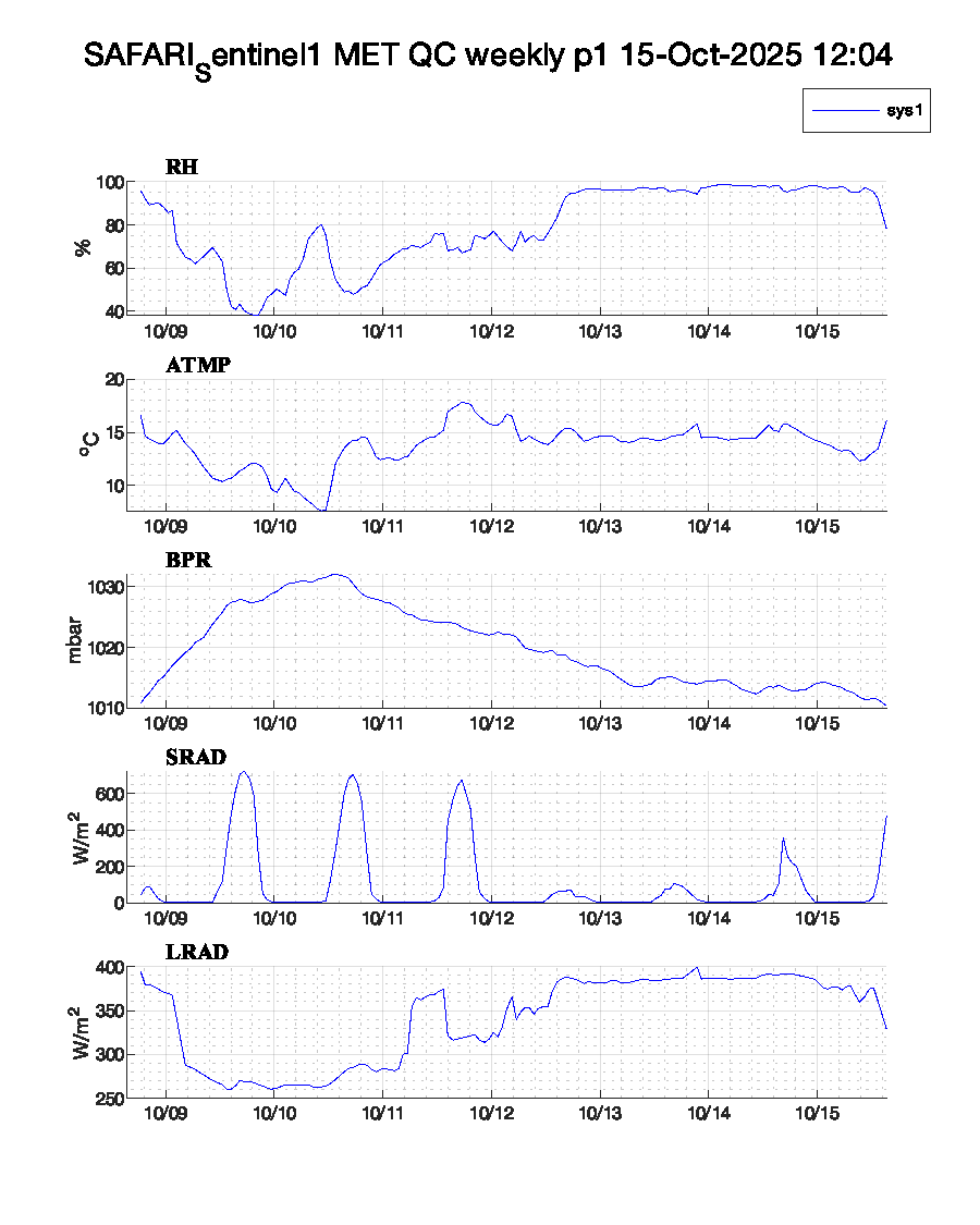
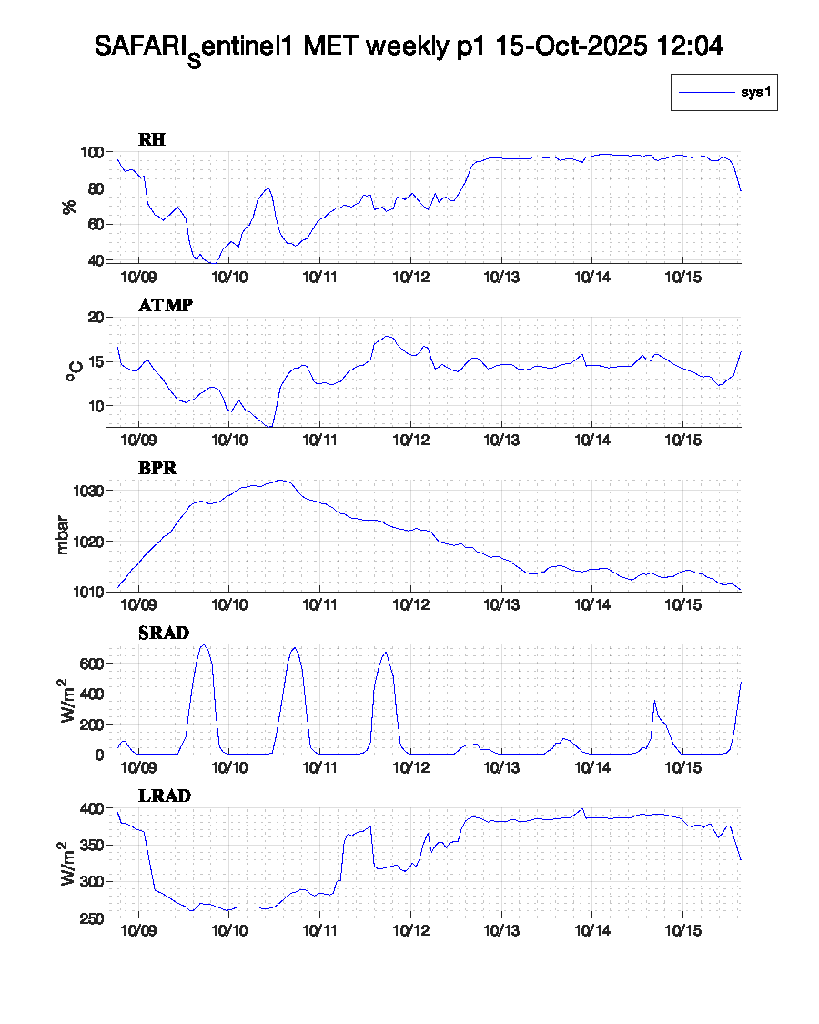
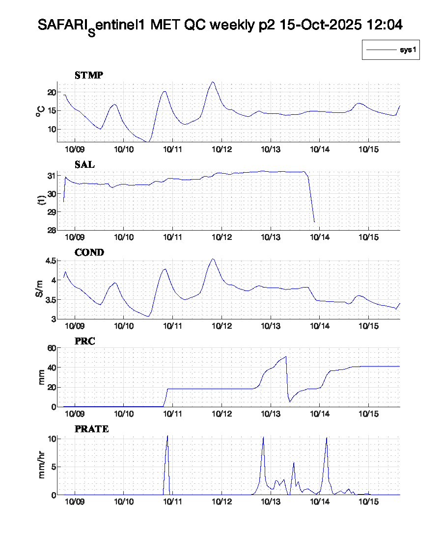
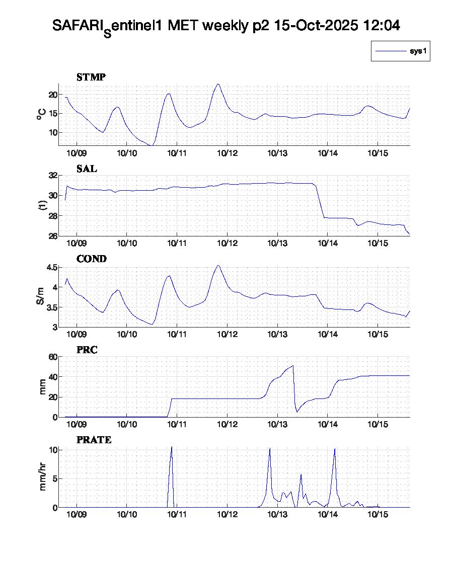
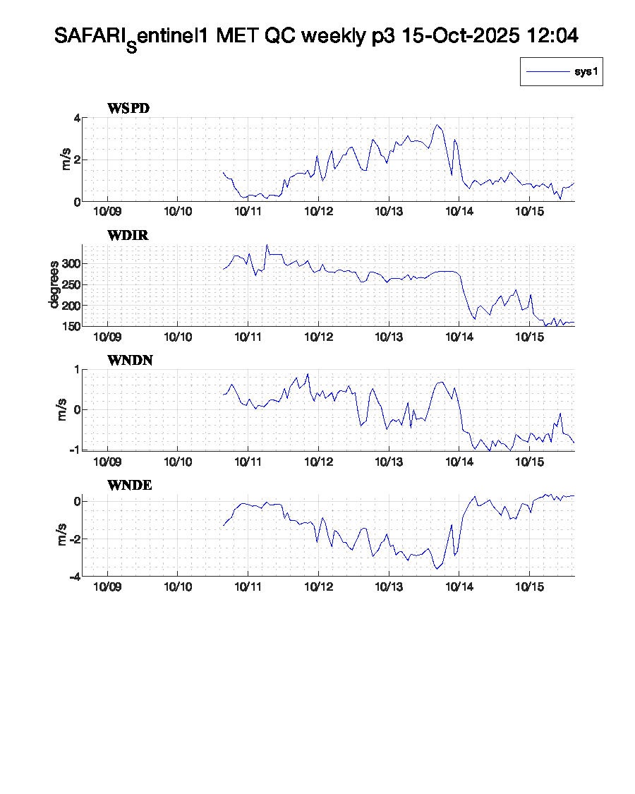
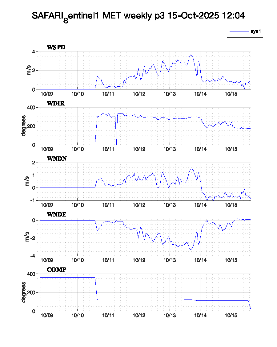
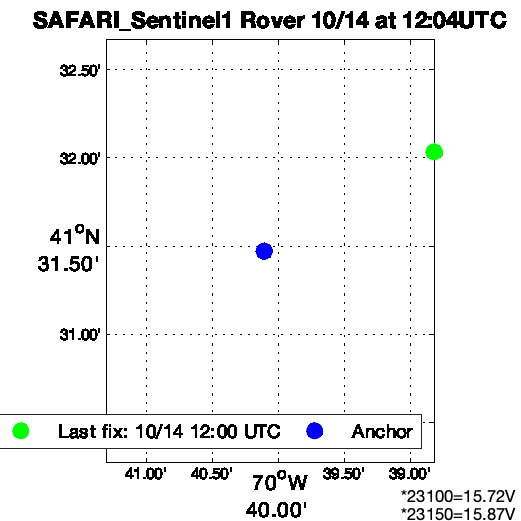
The SAFARI_Sentinel1 buoy is currently in-prep.
Sys 1 2025/10/08 EH SAFARI ASIMET Power on.
| System | SN | IMEI | Daily | Complete | ||
|---|---|---|---|---|---|---|
| Sys1 | 1 | *8800 | Raw | QC | Raw | QC |
SAFARI_Sentinel1 anchor: 41.5245N, 70.6684W.
| Instrument | ID | Daily | Complete | Throughput | |
|---|---|---|---|---|---|
| Xeos Rover | *0123150, *7623100 | Rover GPS | Rover GPS | throughput | |
| Beacon Modem | 300234067204440 | Beacon GPS | |||
| Google Earth | SAFARI_Sentinel1.kml |
 |
| Notes | ASIMet data formats | Resolution | Copy of UOP instrument database | Argos Code | Campbell power consumption tool |
|---|
The WFIP_Lidar buoy was deployed on .
Extra Xeos Rover for Lidar Buoy tracking turned on 7/30/2025.
2024/07/24 RG Pre-deployment test WFIP Lidar Kilo beacon
WFIP_Lidar is not currently anchored; plots will be centered on most recent position data.
| Instrument | ID | Daily | Complete | Throughput | |
|---|---|---|---|---|---|
| Xeos Rover | *7523240 | Rover GPS | Rover GPS | throughput | |
| Beacon Modem | 300234067104880 | Beacon GPS | |||
| Google Earth | WFIP_Lidar.kml |
 |