Bay of Bengal
Monsoon Buoy
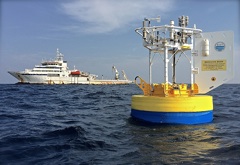
| R.V. Sagar Nidhi and Monsoon Buoy |
 |
| Photo courtesy Sean Patrick Whelan |
 |
| Principal funding provided by Office Of Naval Research |
Atmospheric Forcing and the Structure and Evolution of the Upper Ocean in the Bay of Bengal
Data Access - Real time data
The buoy was deployed on December 8, 2014 at 08:28 UTC from the Research Vessel Sagar Nidhi (Indian National Institute of Ocean Technology), out of Chennai, India. The water depth at the site is 2152 m.
NOTE: this is completely unedited data, please use with caution.
No magnetic correction has been applied to the winds.
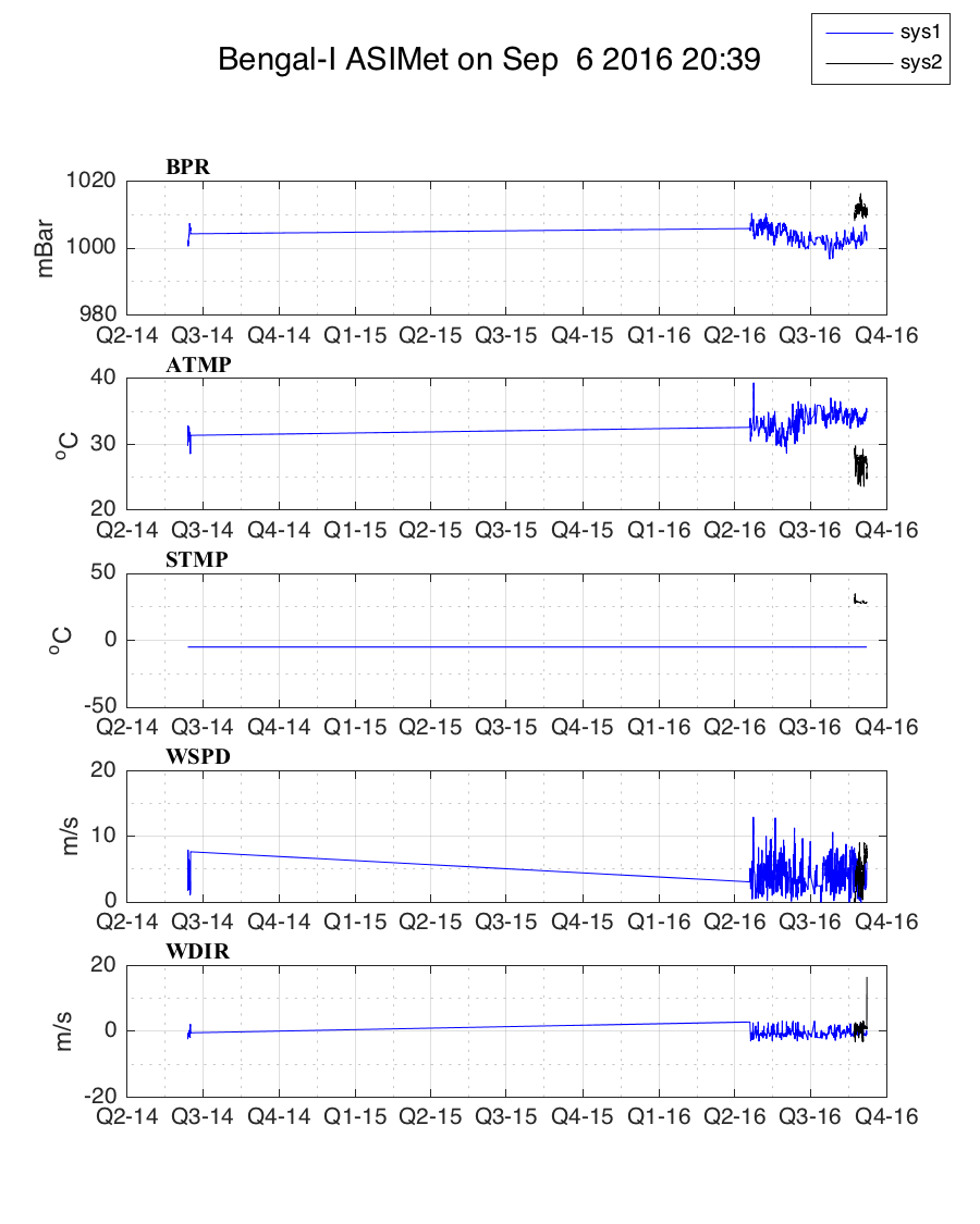
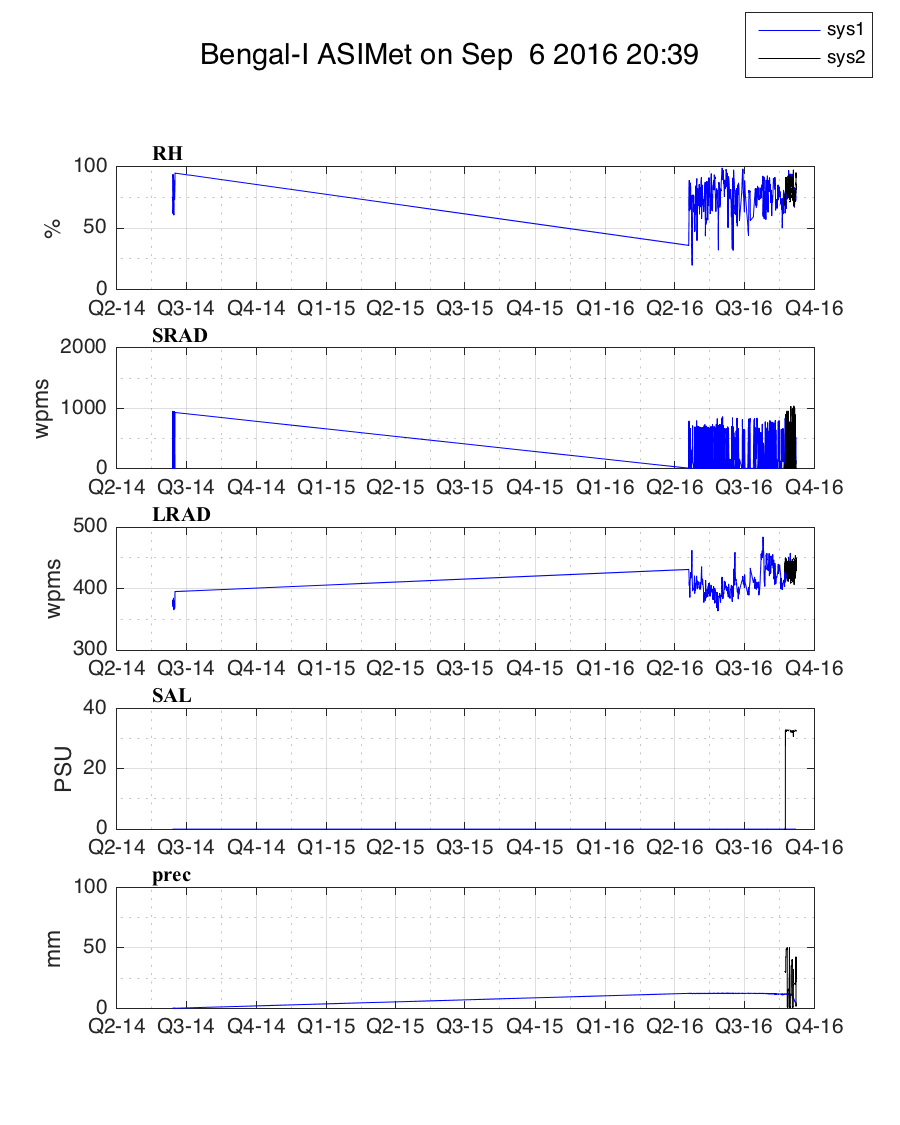
| ASIMet System 1 (SN 39) | ASIMet System 2 (SN 40) |
 |
 |
| Detailed plots: System 1 | System 2 |
File information
- Text files begin with comment lines that begin with % to make them Matlab-compatible.
- Header lines include the processing date, in local (Eastern) time.
- Times in Iridium data records reflect the end of the hour during which averaged data was collected.
- Times in Iridium data records are in UTC
- There is a 'column header' line:
% year mon day yearday hour min bpr atmp sst wnde wndn hrh swr lwr precip cond sal wnds wndd
Name Units Note year 4-digit year mon Month number, starts at 1 day Day of month, starts at 1 yearday Day of year, starts at 1 hour UTC; starts at 0 min minute bpr mB Barometric pressure atmp °C Air temperature sst °C Sea surface temperature wnde m/s Eastward componenet of wind speed wndn m/s Northward componenet of wind speed hrh % Relative humidity swr W/m2 Shortwave radiation lwr W/m2 Longwave radiation precip mm Precipitation level cond 1 Sea surface conductivity sal PSU Sea surface salinity wnds m/s Wind speed wndd ° Wind direction (to)
Page updated: Sept.12, 2019

